Meandering between
nature and water safety
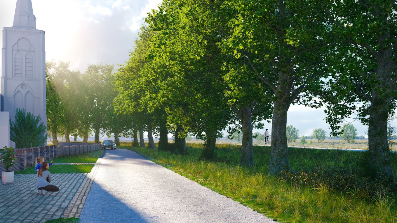
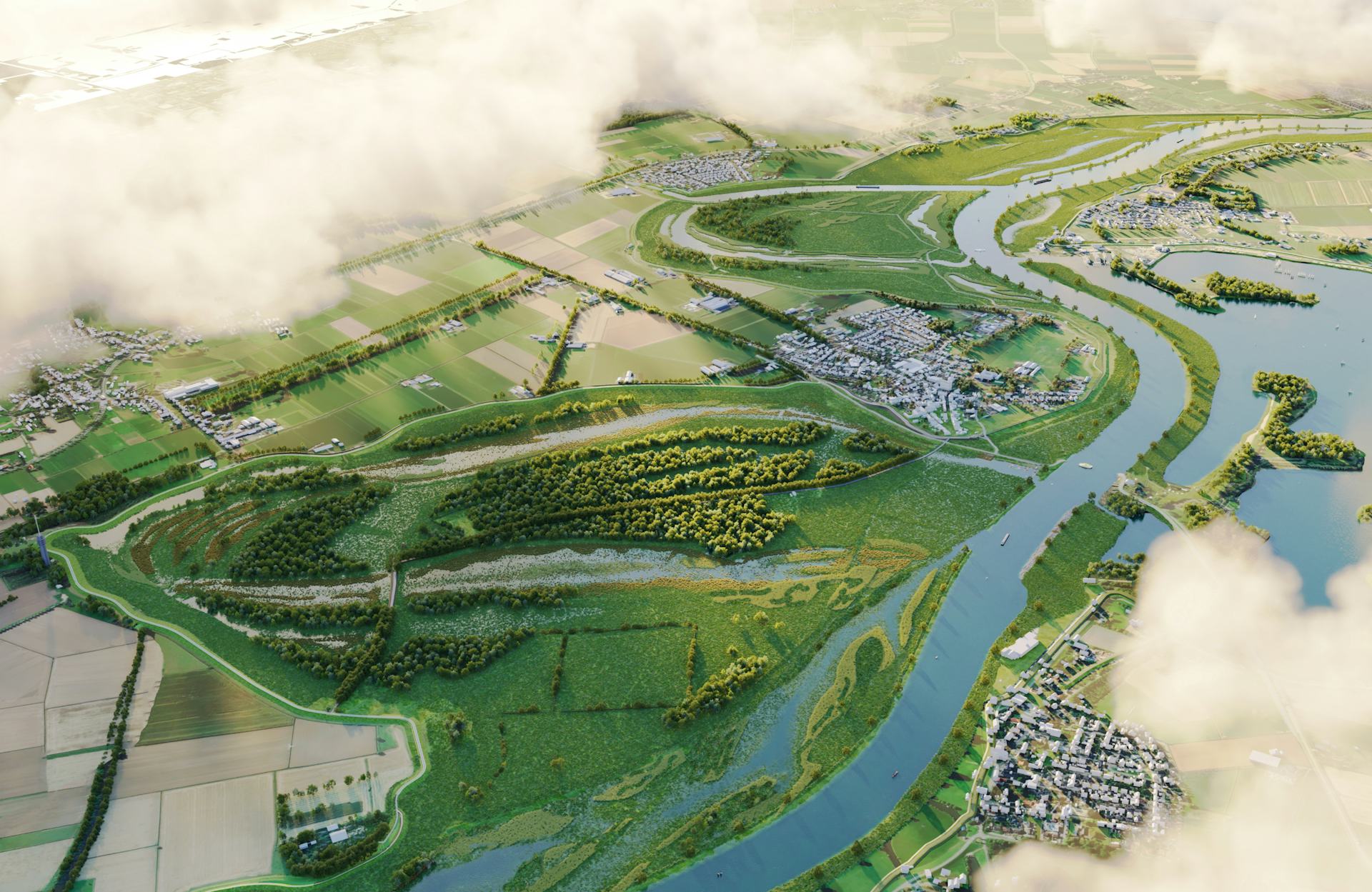
The Meandering Maas project aims to improve the dike between Ravenstein and Lith, provide more space for the River Maas, and seize opportunities for qualitative development in the area. Designing a dike reinforcement and floodplain area involves many sensitivities. Stakeholders critically examine the effects on their property and the consequences for the landscape and spatial quality in the area. We were asked to assist Waterschap Aa en Maas in carefully visualizing these impacts.
With each curve, we embrace nature's beauty and harness its power.
By utilizing visualizations and a 3D animations, we captured the new dynamics of the area. For us visualizing a spatial plan is more than just a functional representation of an idea; it is about evoking feelings and creating a sense of place.
Our challenge was to encapsulate this and make it accessible to everyone, ensuring that the preferred alternative and its significance are comprehensible at various scales, instilling trust and allowing room for interpretation.
Guided by our unwavering vision, we create a powerful and practical illustrative visualization to inform and inspire the stakeholders.
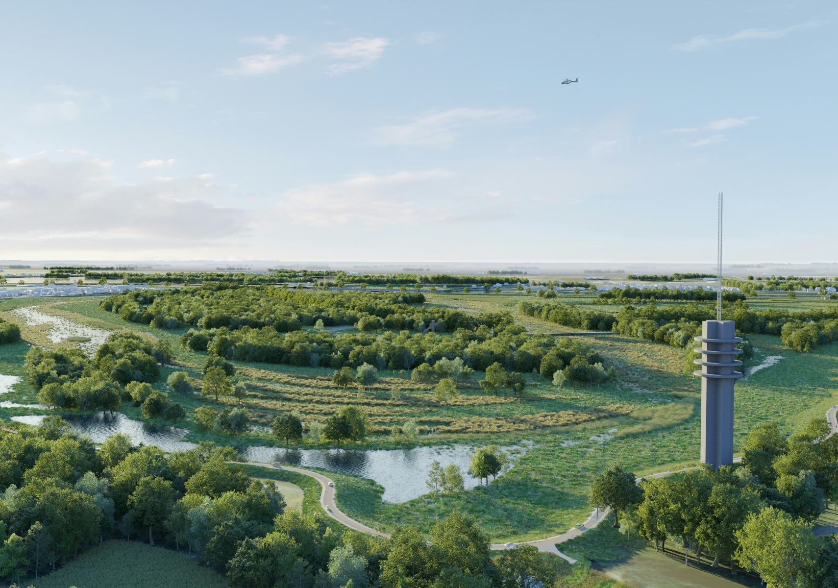
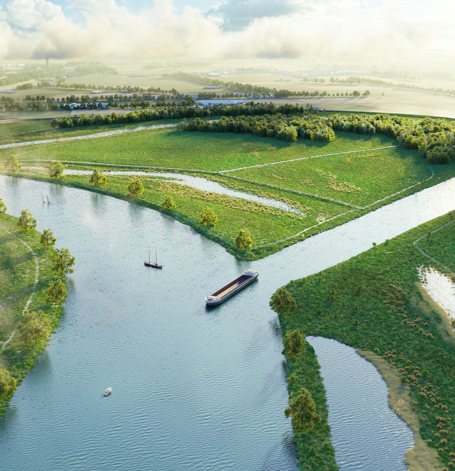
NAP + 500
A view of the Diedensche Uiterdijk with a water level of +5.00 NAP.
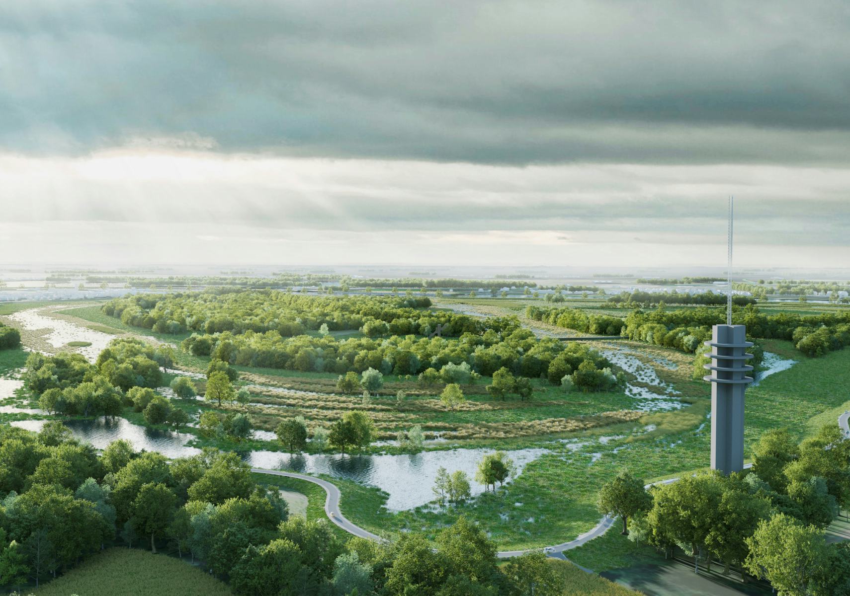
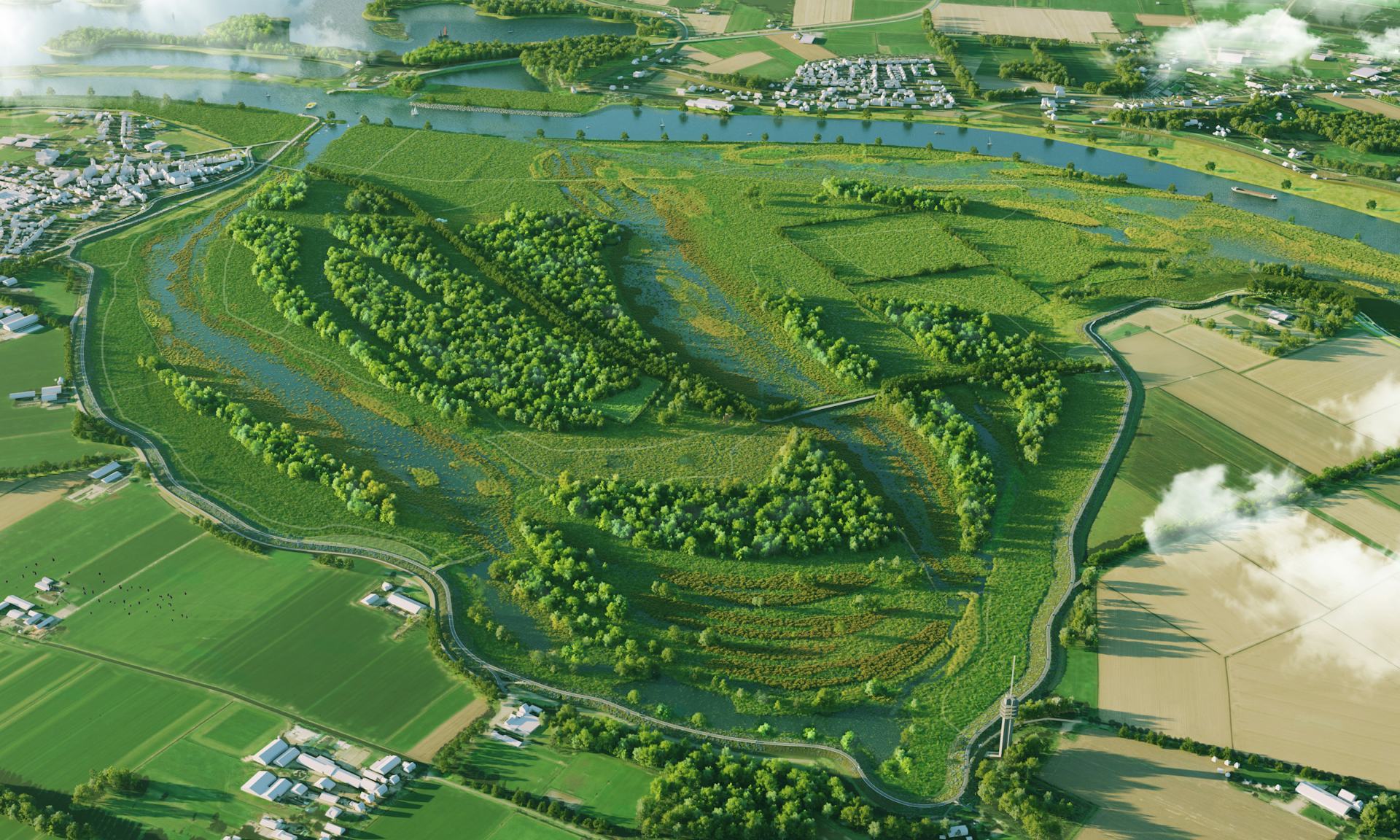
NAP + 5.50
A view of the Diedensche Uiterdijk with a water level of +5.50 NAP
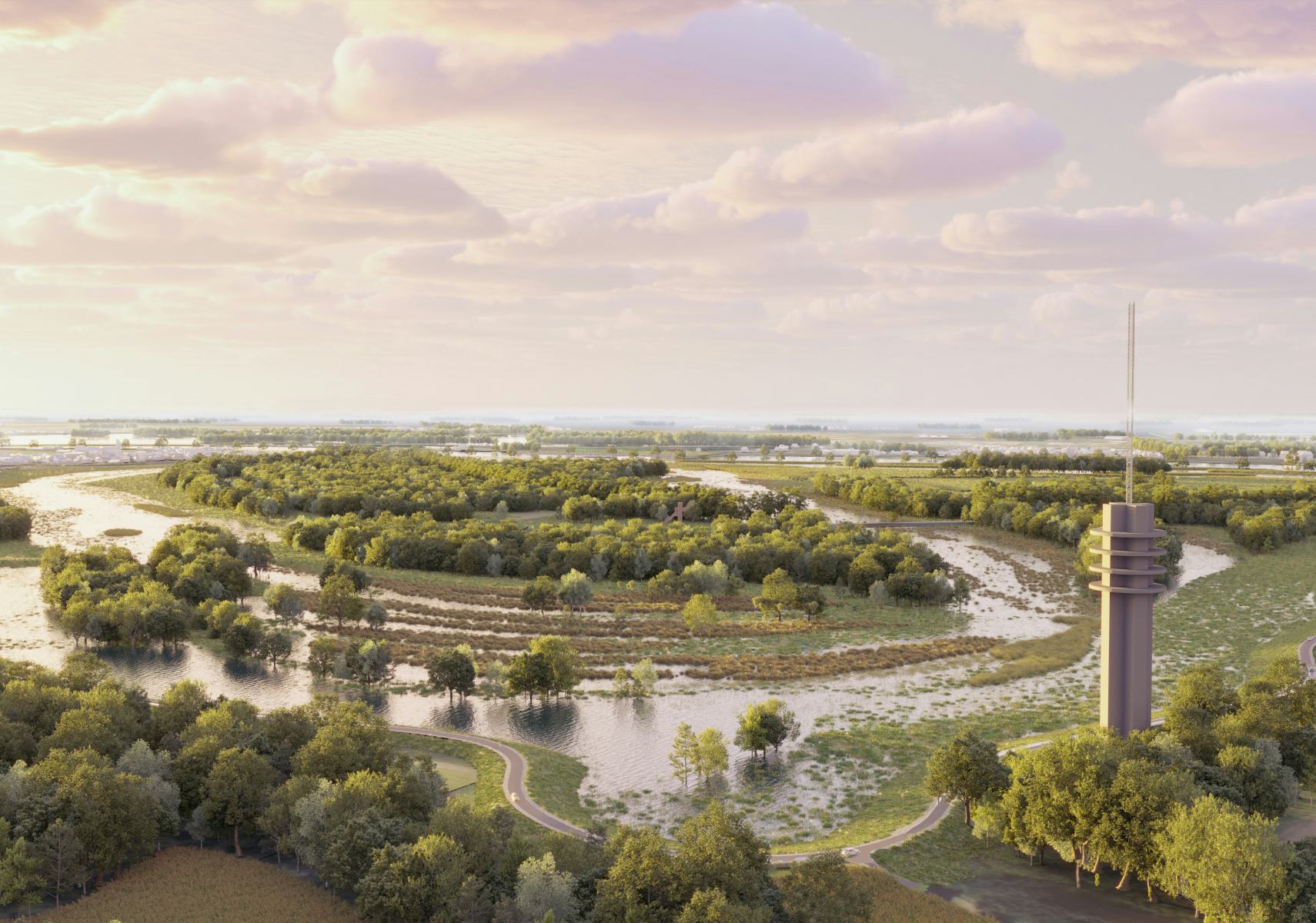
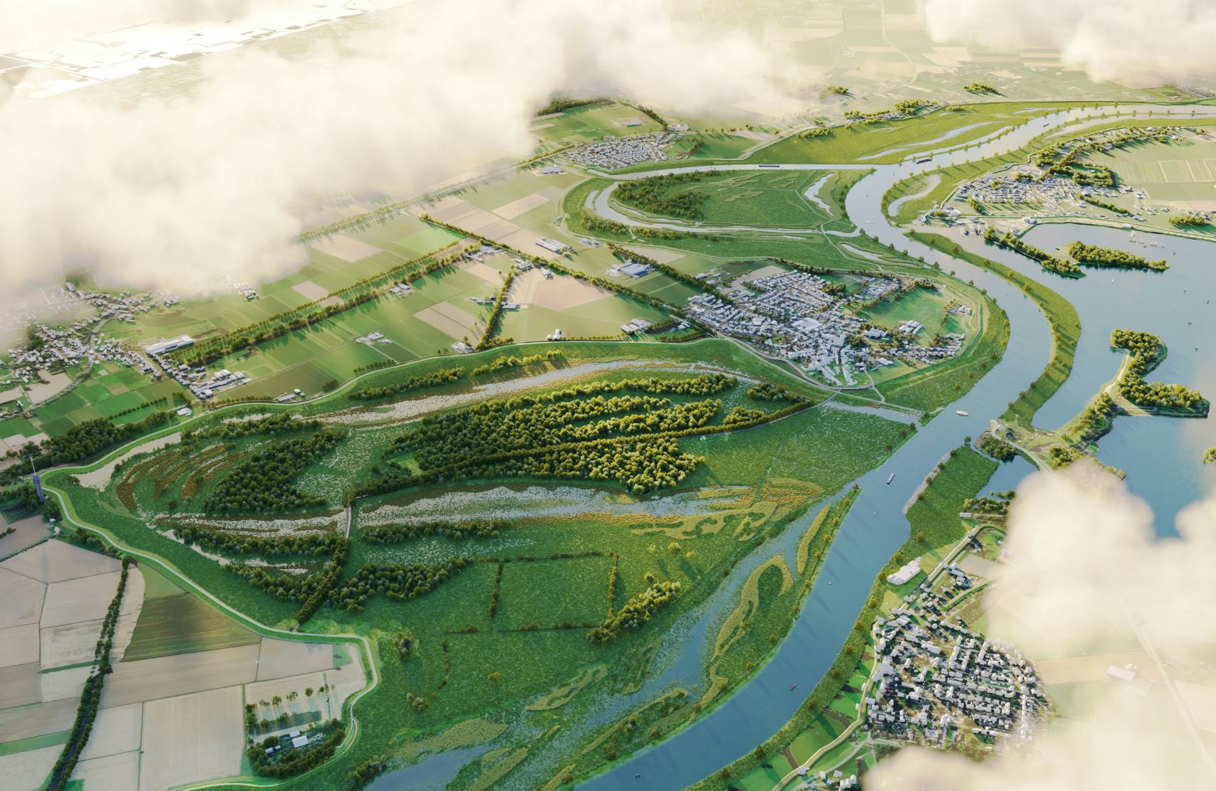
NAP + 6.30
A view of the Diedensche Uiterdijk with a water level of +6.30 NAP
As part of the Heritage Deal, we worked on visuals to explain how the river widening between Ravenstein and Lith can serve a multifaceted purpose. In addition to the intended dike reinforcement, cultural-historical sites can be made visible at several locations along the dike.
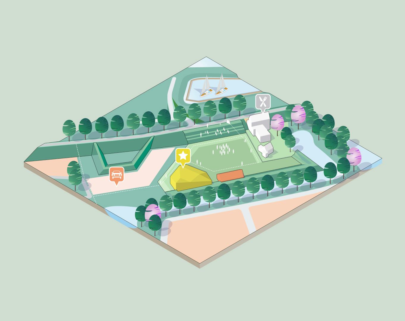
Due to the shorter distances traveled for soil transportation, this not only adds value to spatial quality but also contributes to CO2 reduction.
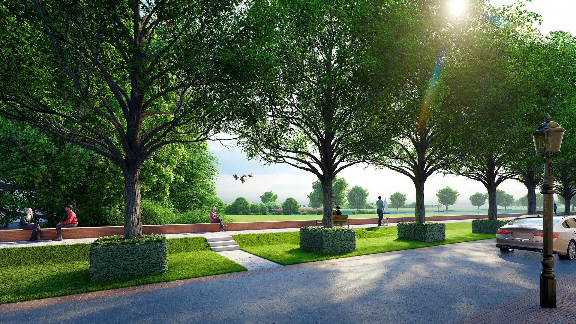
With the visualizations and interactive map, we were able to provide our stakeholders with a glimpse into the future, resulting in strong support
for the design.
For this project, we utilized an online communication tool for spatial projects like Meanderende Maas. By using interactive maps, 3D visualizations, 3D animations, 360-degree panoramas, cross-sections, and explanatory information were presented in a cohesive manner.
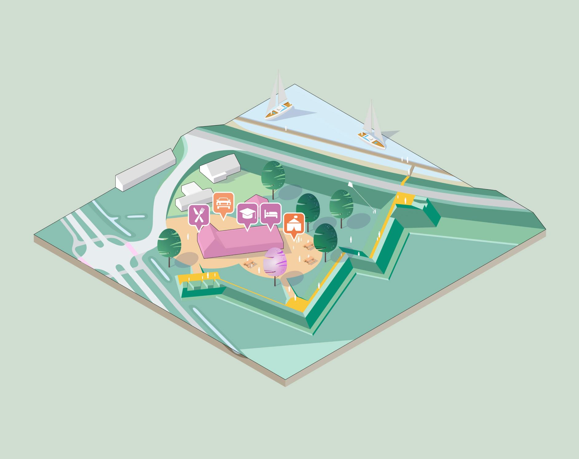
For the new quay wall in Ravenstein, the design was presented to residents using an interactive 3D model. This gave nearby residents an early stage glimpse of the intended end result.